
Search results
Saturday | July 23
October 3, 2011 by admin
Filed under InnerSea Discoveries
Ketchikan
“One final paragraph of advice: Do not burn yourselves out. Be as I am—a reluctant enthusiast—a part-time crusader, a half-hearted fanatic. Save the other half of yourselves and your lives for pleasure and adventure. It is not enough to fight for the land; it is even more important to enjoy it. While you can. While it’s still here. So get out there and hunt and fish and mess around with your friends, ramble out yonder and explore the forests, climb the mountains, bag the peaks, run the rivers, breathe deep of that yet sweet and lucid air, sit quietly for a while and contemplate the precious stillness, the lovely, mysterious and awesome space…” –Edward Abbey
Tlingit speaker Joe comes aboard and entertains our guests with a talk in the lounge. He gets a lot of laughs and applause for his discussion of Tlingit family life. He is from Saxman Village (just a couple of miles from downtown Ketchikan).

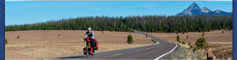
This is the site where an assemblage of totems are on the forested grounds, a photographers delight. An interpretive center and sales area is an attraction for tourists.

Joe tells us it is highly recommended to “spend all your money here in Ketchikan”, and learn more about the dynamic, vibrant culture of the Tlingits.
After working for InnerSea Discoveries since mid-April, today is my going-home day. My buddy Randall Tate also has time-off and we celebrate with our first sip of alcohol—a pint of beer–since early May.

We are amazed at the good taste of the brew at the Arctic Bar. We laugh and give a toast to the ship that happens to be just a “par 3”, or about a “5-iron” shot away from our table.
We enjoy our freedom knowing that our fellow crew members are scurrying about for the impending arrival of the next group of intrepid travelers.
We hop aboard a small motorboat with an eccentric man behind the wheel. He is eating a messy Burger Queen burger and fries as we make our way across the Tongass Narrows to the airport. I ask him if he was for or against the “Bridge to Nowhere” that became famous when Governor Sarah Palin was in office. He was obviously against it as he has a thriving business as a water taxi driver.

I’ll be visiting family and vacationing before returning to Alaska in August to finish the summer season guiding folks in “the Great Land”.

Friday | July 22
October 3, 2011 by admin
Filed under InnerSea Discoveries
Misty Fiords National Monument
“Between the woods the afternoon / Is fallen in a golden swoon /
The sun looks down from quiet skies / To where a quiet water lies, /
And silent trees stoop down to trees, /
And there I saw a white swan make / Another white swan in the lake; /
And, breast to breast, both motionless, / They waited for the wind’s caress…/
And all the water was at ease.”
-A.A. Milne, The Mirror
Just after a hearty breakfast, we motor into the entrance of Walker Cove, drop the kayaks, and offer a 5-mile paddle into the upper reaches of the fiord.

The four of us guides split up and lead groups of several two-person kayakers along the granitic walls on either side of the fiord.

The route is very scenic and offers so much to experience with all of the senses.


Highlights include waterfalls, eagles, seals and colorful sea stars exposed by a very low tide. Most of the sea stars are using thousands of tube-feet to pry-open mussels that are in abundance at the low to mid-tide level. Some of these colorful starfish are dangling by just an arm or two from the undersides of the ebbing tide.

The local geology is a bit complicated due to the number of different terrains that “docked” as accretionary wedges here in Southeast Alaska. I point out two different rocks that look alike by saying: “This is a gneiss rock, do not take it for granite.” The former is metamorphic, undergoing change due to heat and pressure, while the latter is an intrusive igneous rock.

Dikes and sills are seen in the bedding of the rock and are an interesting juxtaposition adjacent to the intertidal zonation of various, colored seaweeds and invertebrates.
At the end of the paddle, we are rewarded with a view of a brown bear feeding along a small river mouth. We get quite close as the bear has little fear of anything that approaches from the water.
The bear is busy digging clams in the tidal flats surrounding the river. Gulls and crows surround the bear for any missed invertebrates that get tossed aside by the bear.
After lunch, we enter Rudyard Bay for some afternoon sightseeing.

We are not the only ones, as we see several floatplanes coming and going. This bay is a very popular area to visit. The flight-seeing is offered by shore excursion managers on the cruise ships that dock in Ketchikan.

While watching a bear, we are surprised by a floatplane that circles our ship then comes in for a landing. The pilot lands with precision in such a manner that even with the engines turned-off, the plane floats right up to the optimal viewing distance. Passengers disembark the planes cabin and walk out onto the pontoons for an unobstructed view. After watching the wildlife for about 20-minutes, the pilot takes off and flies over our ship on its way back to Ketchikan.
Bush pilots like to say that anyone who doesn’t fly is “geographically challenged”. Getting up and over the tree-studded mountains to see the intricate waterways, forests and glaciers is a real lesson in geography.

In the later afternoon and on into the evening we are graced by the presence of several killer whales plying the coniferous-green waters. We cannot quite determine if they are a fish-eating local pod or a mammal-eating transient pod. Nonetheless, they seem to be following us out of Rudyard Bay and back into the Behm Canal.

“Find your place on the planet, dig in, and take responsibility from there.” –Gary Snyder
Monday | July 18
October 3, 2011 by admin
Filed under InnerSea Discoveries
Thomas Bay & Baird Glacier
“Everybody needs beauty as well as bread, places to play in and pray in, where nature may heal and cheer and give strength…” -John Muir
Today (despite the threatening clouds and persistant drizzle) was a fabulous day for a hike on the glacier. Any day on a river of ice is adventurous and all of our guests that joined us had a blast.

The Baird Glacier is so intriguing because of the numerous features that completely baffle the mind as to how they were formed.

Case in point. Partway up the snout of the glacier are a series of longitudinal ablation crevasses that have closed back up and look like sutures on a skull. Pyramids of ice burst up and through these visible fissures and they are completely covered in sand. Sand just inches in thickness, often wet due to the melting ice that lies beneath.

Could it be the result of a jokuhlaup or glacial outburst flood? The pressure of the water pushing up through old crevasses in the ice? Who knows? It is fun to theorize.
We do see a baby tern chick that hides and stays hidden behind a cobblestone.

Other sights:
• a push or terminal moraine
• moulins on the ice surface that look like blue swirling toilet bowls
• a Semi-Palmated Plover that shows us the “broken-wing” tactic
• soft, vibrant green mosses with islands of foliose lichens, pinkish blossoms of the Dwarf Fireweed or River Beauty (Epilobium latifolium)
• 100’s of 1000’s of river-rounded granitic boulders in front of the glacier and angular, iron-rich rocks on top of the glacier
• Arctic Terns dropping down to the waters surface to collect inch-long krill; others fly back to chicks holding fish in their bills
• Harbor seals plying the waters in front of the river

The Baird Glacier comes off of the Stikine Icefield, an area that is approximately 100 miles long from the Whiting River in the north to the Stikine River in the south and about 30 miles wide from tidewater up and over the crest of the Coast Range past the international boundary into British Colombia, Canada.
Our trip upriver was very eventful. Melt-waters of raging Class II rapids. Our larger, heavier boat with 8 passengers barely makes headway. Both boats hit rocks, doing damage to the props. The banks of the river are loosely sorted boulders piled up high and it’s difficult to make progress upriver. For 5 minutes—at full throttle—we make about 200 feet of progress and finally make it to a safe landing spot.
We hike about a kilometer to the terminal moraine directly in front of the glacier. The remnants of broken pieces of ice create boot-sucking mud pits that are best to avoid. Curiosity always makes a few folks push down with just the right amount of pressure on a mud spot to create liquefaction.

Seeing geology in action is what the concept of uniformitarianism is all about, i.e. “the present is the key to the past”. This is what makes the study of the earth so fascinating. One can deduce what is visible in the here and now to landscapes and processes that have been going on for millennia, periods, eras and eons of time.

Sunday | July 17
October 3, 2011 by admin
Filed under InnerSea Discoveries
Tracy Arm & Sawyer Glaciers
“Domes swell against the sky in fine lines as lofty and as perfect in form as those of the California valley, and rock-fronts stand forward, as sheer and as nobly sculpted. No ice-work that I have ever seen surpasses this, either in the magnitude of the features or effectiveness of composition.” –John Muir
John Muir, writing in his book Travels in Alaska, described Tracy Arm as a “wild unfinished Yosemite”.
We awake to a fine day. The anchor is lifted at 6 a.m. and the Wilderness Discoverer cruises up the magnificent fiord that is Tracy Arm. Yosemite-like domes, waterfalls that seem to come right out of the sky, and rainforests that exhibit many shades of green are passed as we motor at the speed of 9-knots up the 23-miles to the face of the Sawyer Glacier.

This is the Tongass National Forest, the largest National Forest in the United States at almost 17 million acres in size. It ranges from the Southeast Alaska panhandle between Ketchikan and Yakutat. It incorporates the Alexander Archipelago, located in the Inside Passage between the Coast Mountain Range and the Gulf of Alaska in the Northeast Pacific Ocean. The Tongass happens to have the largest contiguous, intact temperate rainforest in the world.
The temperate rainforest biome ranges from the narrow strip of land between northern California and Kodiak Island, Alaska. Some of the hallmarks of this rainforest is the presence of Sitka Spruce, a profusion of epiphytes such as mosses and lichens, a climate regime that includes around 100-inches of precipitation a year and the presence of nurse logs.
Small boat tours are offered to bring guests up close to the Sawyer Glacier. Photographic opportunities abound for camera-toting guests.

Brash ice is quite thick. Birds are flying back and forth in front of the tidewater glacier and seals are hauled out on small ice-bergs or “growlers”.
We are lucky to have two wilderness kayak rangers join us with two of their “artists-in-residence” volunteers. Our Tongass National Forest Rangers Solan Jensen and Sean Reilly give an insightful talk on the history of wilderness in the dining lounge.
After disembarking the kayak rangers, we ask guests to participate in three rounds of talks surrounding our adventure program of kayaking, stand-up paddleboarding or SUP, and how to behave in bear country. I lead the talk on SUP in the lounge with an assistant to “model” appropriate techniques.

It’s amazing how SUP has become the latest trend in ocean sports. As a fitness sport, it uses all of the major muscle groups. It works the core and legs while you try to balance and the upper body while paddling.
It’s easy to carry a SUP and that is one of the major advantages over having a sea kayak. On calm, flat days the only real hazard for SUP’ers is navigating wakes from passing boats. These boards are wider and more stable than a regular surfboard. However, I would not recommended trying to walk the nose and “hanging ten”.
For novice paddleboarders, it’s worth trying it more than once to build a comfort level and to see if the sport is enjoyable. Every time you get out on the water while here on vacation will make it that much easier to try it again back home.
The minimal effort of SUP-ing (not a great acronym, I just realized) for just a few minutes while circumnavigating the Wilderness Discoverer will allow a partner or crew to photo-document your efforts. That way you can prove to kith and kin how adventurous you really were in Alaska.

My overall message is to encourage folks to “get up, stand up…stand-up for bragging rights!”
The afternoon is spent whale watching in the waters adjacent to Admiralty Island National Monument. Kootznahoo or “Fortress of the Bears”, has the greatest concentration of brown bears in the world, about 1 bear per square mile on the 1,700 square mile island. We motor too far away to spot brown bears (visitors that want to see bears can go to Pack Creek on the northeast side of the island).
Humpback whales are spotted exhibiting a range of behavior such as spouting, lob-tailing and breaching. These fascinating baleen whales have travelled all the way from Hawai’i to feed all summer long.
Friends stay up late enjoying a lingering twilight and the ever-changing seascapes that almost hypnotize to a state of nirvana.
Saturday | July 16
October 3, 2011 by admin
Filed under InnerSea Discoveries
Juneau
“Between the woods the afternoon / Is fallen in a golden swoon /
The sun looks down from quiet skies / To where a quiet water lies, /
And silent trees stoop down to trees, /
And there I saw a white swan make / Another white swan in the lake; /
And, breast to breast, both motionless, / They waited for the wind’s caress…/
And all the water was at ease.”
-A.A. Milne, The Mirror

Today is shopping day. Yippee! This is my second turnover day since the start of the season where I don’t have to swab the decks with the deck department or break down boxes for the galley and vacuum for the hotel department.
Just getting off of the ship for a spell is good from time to time to stimulate the brain with the small town vibe of Juneau and the best part about it: the Juneau-ites.
Leah–our wellness instructor–and I hit all the big box stores: Home Depot, Fred Meyer and Costco to shop for various items that were requested from the different departments on the ship throughout the week.
We all work hard on these turn-over days and look forward to the arrival of our new guests after disembarking our old guest-friends in the morning.
We wave good-bye to the massive cruise ships docked along the waterfront as the M/V Wilderness Discoverer (WND) heads south through the Gastineau Channel.
“The real voyage of discovery consists not in seeing new landscapes, but in having new eyes.” –Marcel Proust
where is gmack now? innersea discoveries expedition week 11
It has been an exciting week on the InnerSea Discoveries Expedition Click Links Below to read daily updates from Week 11 of the Trip:
July 10 – July 16, 2011
Sunday | July 10
“Kayaking, Sauntering, Kelp-Bugling”

Monday | July 11
“Totems, Plankton, Weather”

Tuesday | July 12
“Invertebrates and Our Sister-Ship”

Wednesday | July 13
“Phantasmagorical Seascapes”

“Tidal Ebb & Flow”

Friday | July 15
“Killer Whales”

Saturday | July 16
“The Capitol City of Juneau”

Saturday | July 16
September 26, 2011 by admin
Filed under InnerSea Discoveries
The Capitol City of Juneau
“Find your place on the planet, dig in and take responsibility from there.” –Gary Snyder
“If I were to choose the sights, the sounds, the fragrances I most would want to see and hear and smell–among all the delights of the open world–on a final day on earth, I think I would choose these: the clear, ethereal song of a white-throated sparrow singing at dawn; the smell of pine trees in the heat of the noon; the lonely calling of Canada geese; the sight of a dragon-fly glinting in the sunshine; the voice of a hermit thrush far in a darkening woods at evening; and–most spiritual and moving of sights–the white cathedral of a cumulus cloud floating serenely in the blue of the sky. Edwin Way Teale, “On a Final Day”
Disembarkation day!
It’s off to many different destinations around the country for our guests. It is very tempting to take them up on their offers to stay if ever we visit their hometowns. Juneau is bustling this morning as we dock alongside the pier adjacent to large cruise ships and a float plane dock
A local tells me that the recent U.S. Census had between 5 and 6,000 people moving out of the capital city of Juneau, a drop from around 31,000 to 25k over the last 10 years.
Crew work hard in anticipation of another group that will board in less than 8 hours.
Friday | July 15
September 26, 2011 by admin
Filed under InnerSea Discoveries
Endicott Arm & Dawes Glacier
“The earth, that is sufficient
I do not want the constellations any nearer,
I know they are very well where they are,
I know they suffice for those who belong to them.”
–Walt Whitman, Leaves of Grass, “Song of the Open Road” (1855)
We lift anchor at 0500 at Wood Spit and enter Holkham Bay, the outlet of both the Tracy and Endicott Arm fiords. We take the route up the Endicott in a thick fog. I assure guests that we should see a clearing close to the glaciers. High pressure is usual near the icefield surrounding the peaks of the Coast Range.

The cold, heavy air sinks down and pushes away the Low Pressure system from the face of the tidewater glacier. As soon as we get within a couple of miles, the fog lifts and we see blue skies and sunshine!

Very little brash ice is seen…mainly growlers with only a few bergy bits and ice-bergs near the spectacular Dawes Glacier. We disembark for small boat tours and stop about ¼-mile away from the 200-foot face of the tidewater glacier. Several small calvings produce the surprisingly loud “white thunder”. The Tlingit Indians had a tribe named after the sound made by the dropping of ice: Sumdum.

We enjoy seeing Arctic Terns diving down for small fish or resting on growlers. Seals were seen frolicking in the white-water of cascading waterfalls.
Two Tongass National Forest Service wilderness kayak rangers paddle over and come aboard for answering questions. Kevin Hood talks about the history of the Wilderness Act and answered questions about harbor seal census counts.
The most amazing thing Ranger Hood shared during his excellent talk was the 2009-2010 studies of the Dawes Glacier. Laser altimetry showed that the Dawes Glacier had thinned or deflated 70 meters in one year, making it one of the fastest wastage and melting areas in the world. Change is happening at a dramatic pace here in the 100-mile long Stikine Icefield!
After dropping the kayaks and the rangers off of our swim-step aft of the vessel, we search hard along the shoreline for four-legged furry animals. We see hundreds of Surf Scoters, otherwise known as the “poor-mans’ puffin” for the similar appearance to the Tufted Puffin. The latter is typically found nesting on protected islands closer to the Gulf of Alaska or in Glacier Bay National Park and Preserve. On the north shoreline, we see the beautiful blooms of the fireweed.
Outside of the Endicott Arm in Stephens Passage, we are lucky to find a pod of killer whales.

We are happy to see many kinds of behavior such as spy-hopping, lob-tailing and breaching.

A young orca was seen surfacing next to its mother.

We suspect these orcas are residents as it looks like they are surrounding and echo-locating for fish. We watch them for quite some time as they happen to be swimming north at the same slow pace that we are motoring.
Anchorage for this evening is just outside of the Taku Inlet. It is the Captains’ Dinner tonight and Marce introduces all of the crew to the rousing applause of our friendly guests.

A bit of sadness is felt as it was time to pack suitcases after a slide show presentation in the lounge shows all of the highlights over the last week of cruising.

is bustling this morning as we dock alongside the pier adjacent to large cruise ships and a float plane dock
A local tells me that the recent U.S. Census had between 5 and 6,000 people moving out of the capital city of Juneau, a drop from around 31,000 to 25k over the last 10 years.
Crew work hard in anticipation of another group that will board in less than 8 hours.
Tuesday | July 12
September 26, 2011 by admin
Filed under InnerSea Discoveries
Blashke Islands
“I went to the woods because I wished to live deliberately, to front only the essential facts of life, and see if I could learn what it had to teach, and not, when I came to die, discover that I had not lived.”
-Henry David Thoreau

The expedition team is up at 0600 for scouting hikes and kayaks in a place we have not been to all season. A small-craft advisory was in effect for Chatham Strait, hence the change in the itinerary for the next three days.
I lead a walk on the north-east side of a complicated but small archipelago of islands. The far reaches of the arm where our group of adventurous hikers are dropped off is an incredibly rich area for intertidal invertebrates. The channel connects with an inner bay only at high tide.

Brightly colored leather stars cover a long and thick bed of mussels.

Dozens of tidepool sculpins are scattered about in tide pools, while a couple of Pacific Staghorn Sculpins succumbed to stressors with their last breaths in the shallow and heated tide-pools.


Air temperatures reached close to 80-degrees Fahrenheit, a veritable heat-wave in Alaska.

We enjoy a couple of hours of bush-whacking to a muskeg or peat bog. Plants include Shore Pine (Pinus contorta various contorta), the carnivorous round-leaf sundew, Labrador tea, sphagnum mosses, cotton grass, and dwarf hemlocks growing out of the acidic soils.

Upon our return to the inner bay of the island complex, everybody wades into the water to clean off the sweat built up from our inland foray.
In the evening everyone gets up on deck for the evening light show along the Wrangell Narrows that splits Kupreanof and Mitkof Islands. I give some interpretation of the navigational markers as we pass through this famous passage. Word is out amongst passengers and crew, that we will be passing—for the first time this summer season—our sister ship, the M/V Wilderness Adventurer.
We all get out on the decks and give a group yell as we pass each other port-to-port at about 5 nautical miles per hour.
Wednesday | July 13
September 26, 2011 by admin
Filed under InnerSea Discoveries
Ideal Cove, Frederick Sound
“Live each day as you would climb a mountain. An occasional glance towards the summit puts the goal in mind. Many beautiful scenes can be observed from each new vantage point. Climb steadily. Slowly, enjoy each passing moment, and the view from the summit will serve as a fitting climax to the journey.” –Joe Porcino
We awake to another hot and sunny day. We are anchored at the mouth of the mighty Stikine River, the longest fast-flowing, un-dammed navigable river in North America. One can motor upstream 170 river-miles to Telegraph Creek.

The glacier and snow-clad Coast Range is stunning in the morning sunshine. I lead a group of kayakers into Ideal Cove adjacent to the 17-mile wide Stikine River delta. Ice-bergs that discharged out of the fiord from the Le Conte Glacier are a brilliant blue against the coniferous-green backdrop of the rainforest.
Port Houghton lies just east of Frederick Sound and the Five Fingers Lighthouse. We go in for sunset and anchorage in Sanborn Arm.

I take a scout boat up Port Houghton Inlet to investigate landings for tomorrows’ hikes. The lighting is ineffable, scintillating and bordering on phantasmagorical. Cloudscapes, landscapes and seascapes are ever-changing and stimulate the brain.
The centuries-old trees in the old-growth forests tower high above the estuarine channel. We spot 100’s of salmon leaping out of the water in anticipation of the spawning to take place in natal streams.
The colorful clouds at sunset are reflected in the still waters. Moments like these are so precious.

Nature can reveal truths to those that have an open mind and heart. Of course, being in the right place at the right time helps.
Thanks to Captain Marce for choosing to bring us here!